LAGO PASCHIET 2003 m
LAGHI VERDI 2142 m
|
Locality: Valli di Lanzo (TO), exactly Val d’Ala Start and finish: Balme, Cornetti
hamlet 1446 m Difference in height: 850 m Total time: 4 h Difficulty: E Necessary equipment: hiking equipment Last ascent: 02/08/2017 Gps track: gpx |
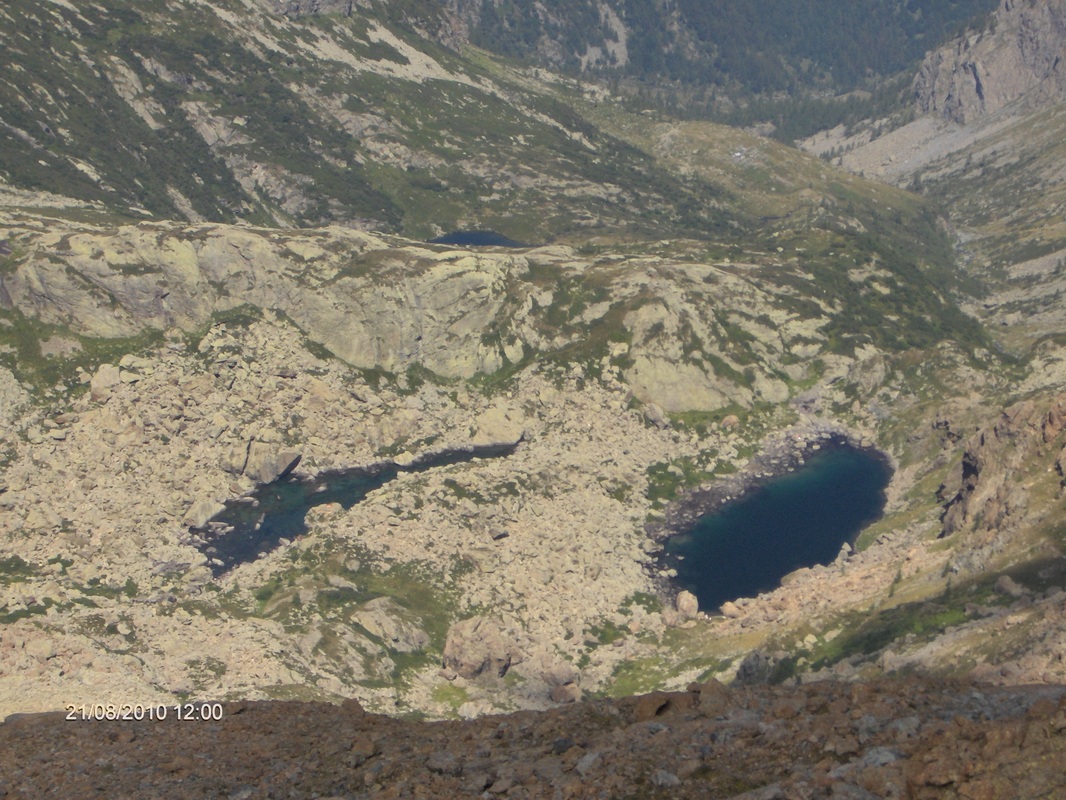
Laghi Verdi and Lago Paschiet seen from Punta Golai
|
Notes
It’s
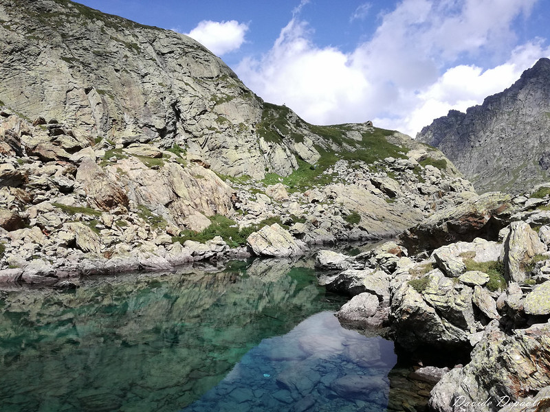
one of the most famous hikes of Val d’Ala. Laghi Verdi
(“Green Lakes”) are called with this name due to their
color, emerald-green. The area is very stunning, overlooked by the Noth wall of Torre
d’Ovarda (“Ovarda Tower”).
The
path is well marked.
Car access
From
Turin take the SP1 road, passing through Venaria Reale, Robassomero, Fiano and Cafasse; then after a gallery you
will be in Lanzo Valleys. Otherwise from Turin pass
through Caselle,
Ciriè, Nole, Mathi, Lanzo and Germagnano;
passed the last one, at a roundabout, you will find the route previously
described. Ignore the indications for Valle di Viù,
pass through Pessinetto,
ignore the indications for Mezzenile, and, at a traffic light, go straight on. Follow the route, passing Ceres, Ala di Stura, Martassina, Mondrone, Molette, Chialambertetto. Arrived near
the “Acqua Pian della Mussa”
facility, ignore the first street on the left, and take the second one
(indications for I Fré).
After having passed a bar, continue on the tiny street till when it bends on
the right, and park the car in the proximity.
Ascent
From
I Fré 1945
m (a Balme
hamlet), cross the Rio Paschiet thanks to a bridge (indications). Follow the GTA
path (Grande Traversata delle
Alpi), overtaking Alpe Pian Salè 1850 m and Alpe Garavela 1744 m. Approximately at 1900 meters above
sea level, turn right following the indications for Lago Paschiet. Crossed the Paschiet river,
after a little rise, the path passes near Alpe Paschiet (without reaching it) and
arrives at Lago Paschiet 2003 m.
Turn left and walk along the lake for a little stretch, then take the path that
climbs the slope which is on the left of the lake (East). After a little
ascent, the track reaches a little hill from which Lago Verde Superiore (the superior of Green
Lakes) is visible. Descent the opposite slope till taking the GTA track
directed to the Paschiet Pass; walk up arriving at Lago Verde Superiore and
at the little building of the Bivacco Gino Gandolfo
(Gino Gandolfo bivouac).
Descent
Go
down along the GTA path, arriving at Lago Verde Inferiore. The track continues passing near some ruins
and descends along the Vallone Paschiet.
Near Alpe Pian Buet 2006 m, ignore the track directed to Colle del Vallonetto, and continue on the GTA path till arriving
at the ramification for Lago Paschiet, to
be ignored. From that place to Balme following the ascent route.
Photogallery
Map
L'Autore declina ogni responsabilità riguardo a eventuali errori e/o omissioni presenti all'interno del sito in questione o a uno scorretto utilizzo del materiale fornito.
L'ambiente alpino è intrinsecamente ricco di pericoli, si raccomanda sempre la massima prudenza e di scegliere itinerari adatti alla propria esperienza. Consultare sempre e con cura le previsioni meteo.
È consentita la riproduzione del materiale presente in questo sito solo su esplicito consenso dell'Autore e citando sempre la fonte.
Condizioni di utilizzo
Copyright 2021 - Davide Depaoli - praeciaplere.weebly.com
